Antique Map Reference Books/Cartobibliographies
A Catalogue of Printed Maps of Greece 1477 - 1800.
ZACHARAKIS, Christos.
Origin: Nicosia, 1982.
Condition: 4to, illus. card wrappers, light wear; pp. 483. Illus.
Size: 280 x 220mm (11 x 8¾ inches).
Reference: 15238
Price: £32
Antique Maps of Cornwall and the Isles of Scilly.
QUIXLEY, R.C.E.
Origin: Penzance, the Author, 1966.
Condition: Oblong 8vo, boards & d/w; pp. 60, illus.
Size: 190 x 260mm (7½ x 10¼ inches).
Reference: 15231
Price: £28
Bel et Utile. The Work of the Robert de Vaugondy Family of Mapmakers.

PEDLEY, Mary Sponberg.
Origin: Tring, Map Collector Publications, 1992.
Condition: 4to, cloth & d/w, pp. 251, illus.
Size: 305 x 240mm (12 x 9½ inches).
Reference: 14887
Price: £68
Bel et Utile. The Work of the Robert de Vaugondy Family of Mapmakers.

PEDLEY, Mary Sponberg.
Origin: Tring, Map Collector Publications, 1992.
Condition: 4to, cloth & d/w, light wear, pp. 251, illus.
Size: 305 x 240mm (12 x 9½ inches).
Reference: 15798
Price: £65
British County Maps: Reference and Price Guide.

BERESINER, Yasha.
Origin: Woodbridge, Antique Collectors' Club, 1983.
Condition: 4to, cloth & illus. d/w, lightly worn, and short tears to d/w; pp. 295, illus.
Size: 285 x 225mm (11¼ x 8¾ inches).
Reference: 14911
Price: £45
Cartographical Innovations. An International Handbook of Mapping Terms to 1900.

WALLIS, Helen & ROBINSON, A.H.
Origin: Tring, Map Collector Publications, 1987.
Condition: 8vo, cloth & d/w, light wear to d/w, otherwise good; pp. xx + 353, illus.
Size: 247 x 182mm (9¾ x 7¼ inches).
Reference: 15787
Price: £58
Collecting Old Maps.

MANASEK, F.J.
Origin: Norwich, Vermont, Terra Nova Press, 1998.
Condition: Large 8vo, cloth & colour illus. d/w, light wear from use; pp. xii + 15-314, profusely illustrated.
Size: 287 x 230mm (11¼ x 9 inches).
Reference: 15797
Price: £38
Collector's Guide to Maps of the African Continent and Southern Africa.

TOOLEY, R.V.
Origin: London, Carta Press, 1969.
Condition: 8vo, cloth, illus. wrappers, worn and short tears; pp. xvi + 132, colour frontis. and 6 plates, + 100 b/w plates. SIGNED by the author.
Size: 255 x 195mm (10 x 7¾ inches).
Reference: 14910
Price: £38
Country Life Book of Antique Maps.

POTTER, Jonathan.
Origin: London, Country Life, 1988.
Condition: 4to, boards and d/w, illus; pp. 207, illus some colour.
Size: 310 x 230mm (12¼ x 9 inches).
Reference: 14975
Price: £18
County Atlases of the British Isles 1579-1850. A Bibliography...

SKELTON, R.A.
Origin: London, Carta Press, 1970.
Condition: 8vo, cloth, d/w slightly worn; pp. viii + 262, illus.
Size: 250 x 200mm (9¾ x 7¾ inches).
Reference: 15181
Price: £25
County Atlases of the British Isles 1579-1850. A Bibliography...

SKELTON, R.A.
Origin: London, Carta Press, 1970.
Condition: 8vo, cloth, d/w slightly worn and soiled; pp. viii + 262, illus.
Size: 260 x 200mm (10¼ x 7¾ inches).
Reference: 15187
Price: £28
County Atlases of the British Isles 1579-1850. A Bibliography...

SKELTON, R.A.
Origin: London, Carta Press, 1970.
Condition: 8vo, cloth, d/w worn and chipped; pp. viii + 262, illus.
Size: 255 x 195mm (10 x 7¾ inches).
Reference: 15220
Price: £34
Die Karten von Amerika in dem Islario General des Alonso de Santa Cruz.

WIESER, Franz R.
Origin: Innsbruck, 1908.
Condition: 4to, paper wrappers, soiled and stained, with some chipping and wear; pp. xx +59 + XV b/w plates on card.
Size: 405 x 305mm (16 x 12 inches).
Reference: 15162
Price: £35
Die Reise ins Seilige Land ein reisebericht aus dem jahre 1483.

BREYDENBACH, Bernhard von.
Origin: Weisbaden, Guido Pressler 1961.
Condition: 4to, cloth & d/w, worn and lightly soiled. illus; pp. 56 iilus.
Size: 305 x 210mm (12 x 8¼ inches).
Reference: 15805
Price: £120
English Privateering Voyages to the West Indies 1588-1595.

ANDREWS, Kenneth R.
Origin: Cambridge, Hakluyt Society, 1959.
Condition: 8vo. blue embossed cloth, gilt, printed d/w; pp. xxvii + 421, illus, map.
Size: 225 x 150mm (8¾ x 6 inches).
Reference: 15387
Price: £21
Hebrew Maps of the Holy Land.

WAJNTRAUB, E & G.
Origin: Vienna, Brüder Hokkinek, 1992.
Condition: 4to, cloth, illus. paper d/w, light wear; xiii + pp.277, illus.
Size: 288 x 234mm (11¼ x 9¼ inches).
Reference: 16122
Price: £60
Het Land van de Bijbel: Oude kaarten en prenten van Israel.

SLUYS, W.G.J. van der.
Origin: Belgium, Mappamundi Knokke, 1986.
Condition: Large 4to, cloth & d/w; pp. 143, illus. Dutch text.
Size: 390 x 305mm (15¼ x 12 inches).
Reference: 16121
Price: £45
History of Cartography. Revised and enlarged by R.A. Skelton...

BAGROW, Leo.
Origin: London, C.A. Watts, 1964.
Condition: Large 8vo, cloth & d/w sl.worn and a small section of d/w missing on the spine, card slip case; pp. 312, 21 colour plates + 116 half-tone illus.
Size: 275 x 200mm (10¾ x 7¾ inches).
Reference: 14604
Price: £90
Holy Land in Maps

TISHBY, Ariel.
Origin: Jerusalem, The Israel Museum, 201.
Condition: 4to; illus paper d/w; light wear to d/w, old dedicated inscription on front endpaper, pp. 168, fully illustrated, colour.
Size: 276 x 237mm (10¾ x 9¼ inches).
Reference: 15799
Price: £40
Isles of Gold. Antique Maps of Japan.

CORTAZZI, Hugh.
Origin: New York, John Weatherhill, 1983.
Condition: 4to, cloth & illus. d/w; pp. 177, illus.
Size: 305 x 245mm (12 x 9¾ inches).
Reference: 14965
Price: £48
Japan: A Cartographic Vision. European Printed Maps from the Early 16th to the 19th Century.

WALTER, Lutz (ed.).
Origin: Munich & New York, Prestel, 1994.
Condition: 4to, cloth & d/w, slightly worn, old ownership signature on front endpaper; pp. 232, illus.
Size: 315 x 250mm (12½ x 9¾ inches).
Reference: 14954
Price: £38
Japan: A Cartographic Vision. European Printed Maps from the Early 16th to the 19th Century.

WALTER, Lutz (ed.).
Origin: Munich & New York, Prestel, 1994.
Condition: 4to, cloth & d/w, slightly worn, old ownership signature on front endpaper; pp. 232, illus.
Size: 315 x 250mm (12½ x 9¾ inches).
Reference: 15800
Price: £40
Joan Blaeu and His Grand Atlas.

KOEMAN, C.
Origin: Amsterdam, Theatrum Orbis Terrarum Ltd, 1970.
Condition: 8vo, printed wrappers, light wear; pp. vi + 114, illus.
Size: 230 x 160mm (9 x 6¼ inches).
Reference: 14081
Price: £10
Life of Sir Robert Dudley.
TEMPLE- LEADER, John.
Origin: Amsterdam, Meridian, 1977.
Condition: 8vo, printed d/w, with small tear to front cover, pp.108+, illus.
Size: 230 x 160mm (9 x 6¼ inches).
Reference: 15791
Price: £30
Livio Sanuto Geografia dell' Africa. Venice 1588.

SKELTON, R. A. (Introduction).
Origin: Amsterdam, Theatrum Orbis Terrarum, 1965.
Condition: Folio, cloth & d/w sl.worn; pp. x + 300 +, fully illus.
Size: 460 x 340mm (18 x 13½ inches).
Reference: 14817
Price: £85
Mapmakers of the Sixteenth Century and their Maps: bio-biographies of the Cartographers of Abraham Ortelius, 1570.

KARROW Jr, Robert W.
Origin: Chicago, Speculum Orbis Press, 1993.
Condition: 8vo, cloth & d/w, almost as new; pp. 846, illus.
Size: 263 x 195mm (10¼ x 7¾ inches).
Reference: 15796
Price: £150
Maps and History. Constructing Images of the Past.

BLACK, Jeremy.
Origin: New Haven & London, Yale University Press, 1997.
Condition: 8vo, cloth, illus. d/w; pp. 267, some illus.
Size: 255 x 183mm (10 x 7¼ inches).
Reference: 15012
Price: £18
Maps and Map-Makers.

TOOLEY, R.V.
Origin: London, B.T. Batsford, 1972. Fifth Editon.
Condition: 8vo, cloth & illus. d/w, light soiling, otherwise good; pp. xv + 140, illus.
Size: 255 x 197mm (10 x 7¾ inches).
Reference: 15794
Price: £30
Maps of the Holy Land. Cartobibliography of Printed Maps, 1475-1900.

LAOR, Eran.
Origin: New York, Alan R. Liss, 1986.
Condition: Oblong 4to, cloth & d/w worn, covered in clear plastic wrapper, many ink annotations for various entries indicating maps in the former owners collection; pp. xx + 201, illus.
Size: 270 x 317mm (10¾ x 12½ inches).
Reference: 15802
Price: £150
Maps of the Holy Land. Images of Terra Sancta through Two Millennia.

NEBENZAHL, Kenneth.
Origin: New York, Abbeville Press, Israeli Edition, Steimatsky, 1986.
Condition: Folio; cloth & colour illus. d/w, 164, fully illus.
Size: 390 x 310mm (15¼ x 12¼ inches).
Reference: 15807
Price: £50
Maps that Made History. The Influential, the eccentric and the sublime.

SMART, Lez.
Origin: Surrey, The National Archive, 2004.
Condition: 4to, cloth, illus d/w; pp.191, fully illus.
Size: 270 x 205mm (10¾ x 8 inches).
Reference: 15467
Price: £18
Mare Balticum. The Baltic - Two Thousand Years.

NURMINEN, Juha et al.
Origin: Helsinki, John Nurminen Foundation, 1995.
Condition: New. 4to, cloth & d/w, cardboard slipcase; pp. 287, illus.
Size: 350 x 260mm (13¾ x 10¼ inches).
Reference: 14449
Price: £21
Mediaeval Geography. An Essay in Illustrations of the Hereford Mappa Mundi.

BEVAN, The Rev. W. L. & PHILLOTT, The Rev H. W.
Origin: Amsterdam, Meridian, 1969.
Condition: 8vo, printed wrappers; pp. xlvii + 182.
Size: 230 x 160mm (9 x 6¼ inches).
Reference: 15248
Price: £18
Mercator - The Man Who Mapped the Planet.

CRANE, Nicholas.
Origin: London, Weidenfeld & Nicolson, 2002.
Condition: 8vo, with illus. d/w, used, overall good condition, pp. 348, illustrated.
Size: 242 x 170mm (9½ x 6¾ inches).
Reference: 15790
Price: £25
Mercator: A Monograph of the lettering of maps, etc. in the 16th century Netherlands with a facsimile and translation of his treatise on the italic hand and a translation of Ghim's Vita Mercatoris.

OSLEY, A.S.
Origin: London, Faber & Faber, 1969.
Condition: 4to, cloth & d/w, slightly soiled and worn; pp. 209, illus.
Size: 287 x 225mm (11¼ x 8¾ inches).
Reference: 14435
Price: £58
Mercator: A Monograph of the lettering of maps, etc. in the 16th century Netherlands with a facsimile and translation of his treatise on the italic hand and a translation of Ghim's Vita Mercatoris.

OSLEY, A.S.
Origin: London, Faber & Faber, 1969.
Condition: 4to, cloth & d/w slightly worn and torn at back; pp. 209, illus.
Size: 290 x 230mm (11½ x 9 inches).
Reference: 14944
Price: £35
Miniature Antique Maps.

KING, Geoffrey L.
Origin: Oxfordshire, Tooley, Adams & Co. 2024, third edition.
Condition: 8vo, printed boards illus, NEW; pp. 660, fully illus.
Size: 220 x 160mm (8¾ x 6¼ inches).
Reference: 14874
Price: £55
My Head is a Map: Essays & Memoirs in honour of R.V. Tooley.

WALLIS, Helen & TYACKE, Sarah (eds).
Origin: London, Francis Edwards & Carta Press, 1973.
Condition: 8vo,one of 30 copies printed on special paper bound by Messrs Sangorski & Sutcliffe numbered and signed by R.V.Tooley; pp. xvi + 148, illus.
Size: 252 x 190mm (10 x 7½ inches).
Reference: 14123
Price: £60
Printed Maps of Bermuda.

PALMER, Margaret.
Origin: London, MCC, n.d. [c.1970].
Condition: 8vo, cloth & d/w, short tear; pp. iv + 26 + colour frontis. and 31 plates.
Size: 260 x 195mm (10¼ x 7¾ inches).
Reference: 13911
Price: £28
Saxton's Survey of England and Wales. With a facsimile of Saxton's wall-map of 1583.

SKELTON, R.A.
Origin: Amsterdam, N.Israel, 1974.
Condition: Folio, decorative cloth; pp. 26, with two large facsimile maps.
Size: 495 x 345mm (19½ x 13½ inches).
Reference: 14593
Price: £65
Sea Charts of the Early Explorers.

JOURDIN, Michel Mollat du, et al.
Origin: New York, Thames & Hudson, 1984.
Condition: 4to, red cloth & pictorial dustwrapper, cardboard slipcase; pp. 298, illus., mostly in colour.
Size: 346 x 254mm (13½ x 10 inches).
Reference: 15804
Price: £60
Six Early Printed Maps selected from those exhibited at the British Museum on the occasion of the International Geographical Congress, 1928.

British Museum.
Origin: London, British Museum & Bernard Quaritch, 1928.
Condition: Folio, printed boards, pp. (iv) + 6 facsimile maps, 4 double-page. Lightly soiled.
Size: 440 x 325mm (17¼ x 12¾ inches).
Reference: 14935
Price: £52
Studies in Carto-Bibliography, British and French, and in the Bibliography of Itineraries and Road-Books.

FORDHAM, Sir Herbert George.
Origin: Oxford, Clarendon 1914. First edition.
Condition: 8vo, boards; pp.x + 180, 4 illus.
Size: 230 x 160mm (9 x 6¼ inches).
Reference: 14369
Price: £18
Studies in Carto-Bibliography, British and French, and in the Bibliography of Itineraries and Road-Books.

FORDHAM, Sir Herbert George.
Origin: London, Dawsons, 1969.
Condition: 8vo, boards; pp.x + 180, 4 illus.
Size: 230 x 160mm (9 x 6¼ inches).
Reference: 14914
Price: £15
Studies in Carto-Bibliography, British and French, and in the Bibliography of Itineraries and Road-Books.

FORDHAM, Sir Herbert George.
Origin: London, Dawsons, 1969.
Condition: 8vo, boards; pp.x + 180, 4 illus.
Size: 227 x 153mm (9 x 6 inches).
Reference: 15473
Price: £18
The Earliest Printed Maps 1472-1500.
CAMPBELL, Tony.
Origin: London, British Library, 1987.
Condition: 8vo, cloth, printed wrappers, lightly worn and covered with plastic protector; pp. xi + 244, illus.
Size: 288 x 213mm (11¼ x 8½ inches).
Reference: 15788
Price: £75
The Hebrew Maps of Palestine. A Research in Hebrew Cartography

VILNAY, Zev.
Origin: Jerusalem, Jewish Palestine Exploration Society, 1944.
Condition: Oblong 8vo; pages loose, worn boards, illustrated, with List of Map and plans in English, Hebrew text, pp.40.
Size: 250 x 350mm (9¾ x 13¾ inches).
Reference: 15792
Price: £80
The History of Topographical Maps. Symbols, Pictures and Surveys with 116 illustrations, 10 in colour.

HARVEY, P.D.A.
Origin: London, Thames & Hudson, 1980.
Condition: 8vo, cloth & d/w, pp. 199, illus.
Size: 260 x 195mm (10¼ x 7¾ inches).
Reference: 14901
Price: £24
The Holy Land in Old Prints and Maps.

VILNAY, Zev.
Origin: Jerusalem, Rubin Mass, 1965.
Condition: 4to; cloth, printed d/w, some wear to d/w; pp. 296, fully illus. throughout. 2nd edition.
Size: 320 x 230mm (12½ x 9 inches).
Reference: 16123
Price: £80
The Mapping of America. With an Index compiled by Douglas Matthews.

TOOLEY, R.V.
Origin: London, Holland Press, 1980.
Condition: 8vo, cloth, with light wear; pp. xii + 519, illus.
Size: 255 x 200mm (10 x 7¾ inches).
Reference: 15288
Price: £85
The Mapping of the World. Early Printed World Maps 1472-1700.

SHIRLEY, Rodney W.
Origin: London, The Holland Press, 1984.
Condition: Folio, cloth & d/w, slightly faded at spine, illus; pp. xlviii + 670, fully illus.
Size: 346 x 250mm (13½ x 9¾ inches).
Reference: 14988
Price: £180
The Quest for Longitude.

ANDREWES, William J.H.
Origin: Harvard College, 1998.
Condition: 4to, cloth & d/w. pp. 437. Fully illustrated many in colour.
Size: 290 x 230mm (11½ x 9 inches).
Reference: 14459
Price: £28
The Sea Chart. An Historical Survey based on the Collections in the National Maritime Museum.

HOWSE, Derek & SANDERSON, Michael.
Origin: Newton Abbot, David & Charles, 1973.
Condition: 4to, cloth & pictorial d/w, slightly worn, minor soiling; pp. 144, 60 plates.
Size: 285 x 230mm (11¼ x 9 inches).
Reference: 15216
Price: £24
The Southeast in Early Maps. With an annotated check list of printed and manuscript regional and local maps of southeastern North America during the Colonial period.

CUMMING, William P.
Origin: Chapel Hill, University of North Carolina, 1973.
Condition: 4to, cloth, light wear; pp. ix + 284.
Size: 285 x 230mm (11¼ x 9 inches).
Reference: 15259
Price: £52
Thompson's Maps of Connecticut. Two volumes in one.

THOMPSON, Edmund.
Origin: Norwich, Vermont, G.B. Manasek, 1995.
Condition: 8vo, blue cloth gilt; pp. 66 + (iv) + 111, illus.
Size: 275 x 190mm (10¾ x 7½ inches).
Reference: 15076
Price: £18
Tooley's Dictionary of Mapmakers Supplement.
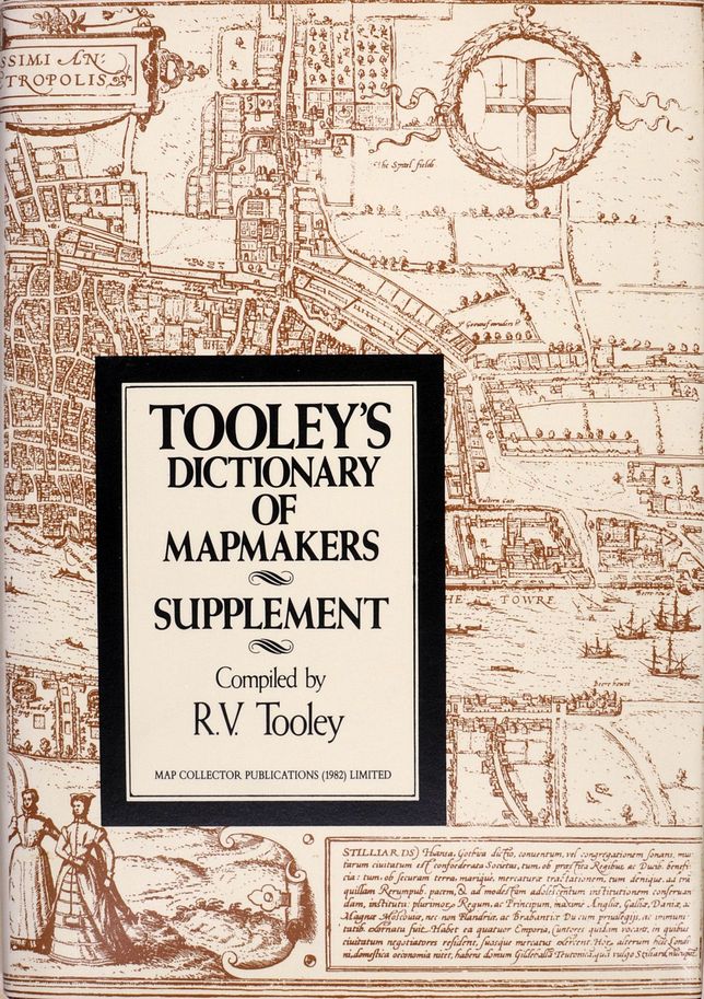
TOOLEY, R.V.
Origin: Tring, Map Collector Publications, 1985.
Condition: 8vo, cloth & d/w, pp. x + 116, illus.
Size: 263 x 185mm (10¼ x 7¼ inches).
Reference: 15001
Price: £48
Tooley's Dictionary of Mapmakers. With a Preface by Helen Wallis.

TOOLEY, R.V.
Origin: Tring, Map Collector Publications, 1979.
Condition: 8vo, cloth & illus. d/w, light signs of use to d/w; pp. xii + 684, illus.
Size: 264 x 185mm (10½ x 7¼ inches).
Reference: 15793
Price: £75
Tudor Townscapes.

SPEED, Jeffrey John.
Origin: Waddesden, Bucks, Map Collector Publications, 2000.
Condition: Oblong 8vo, pictorial wrappers; pp. 172, fully ilustrated in colour.
Size: 215 x 300mm (8½ x 11¾ inches).
Reference: 14770
Price: £15
World. An Excerpt from the British Museum Catalogue of Printed Maps, Charts and Plans Photolithographic Edition to 1964.

British Museum Catalogue.
Origin: London, British Museum, 1967.
Condition: 4to, cloth; unpaginated, approx 250pp.
Size: 340 x 240mm (13½ x 9½ inches).
Reference: 14939
Price: £15
